Força Aeroespacial - Exército de Libertação Popular(China)

Área para discussão de tudo que envolve a aviação civil e atividades aeroespaciais em geral como aeronaves, empresas aéreas, fabricantes, foguetes entre outros.

Moderador: Conselho de Moderação

Mensagem
Autor
Avatar do usuário
Suetham
Sênior
Sênior
Mensagens: 9623
Registrado em: Ter Abr 12, 2022 9:10 am
Agradeceu: 297 vezes
Agradeceram: 615 vezes

Força Aeroespacial - Exército de Libertação Popular(China)

#1 Mensagem por Suetham » Sáb Jun 15, 2024 3:10 pm

Suetham escreveu: Sáb Jun 15, 2024 1:47 pm
Nova estrutura do PLA

Quatro serviços armados das forças armadas:
▪️ Forças terrestres
▪️ Marinha
▪️ Força Aérea
▪️ Tropas de foguetes.

Quatro ramos distintos das forças armadas, os três primeiros dos quais foram criados como resultado da reforma do PLASSF:
▪️ Forças espaciais militares
▪️ Forças do ciberespaço
▪️ Forças de apoio à informação
▪️ Forças logísticas conjuntas
Com a criação da Força Aeroespacial do PLA, resolvi criar esse tópico.

https://en.wikipedia.org/wiki/People%27 ... pace_Force
The People's Liberation Army Aerospace Force is an arm of the People's Liberation Army. It was established on 19 April 2024.[1] Chinese state media has also referred to it as the People's Liberation Army Space Force.[2]

History
The PLA Aerospace Force was established on 19 April 2024, severed from the simultaneously disestablished Strategic Support Force.[3][4] The PLAASF consolidates all the PLA's space-based C4ISR systems, as well as administering all the existing launch sites, and all other military satellites and space assets.

Organization
The PLAASF is headquartered in the Haidian District of Beijing.

Central staff sections include:
Staff department (参谋部)
Information and Communications Division (信息T处)
Political Work Department[5] (政治工作部)
Cadre Bureau[5](干部局)
Innovation Office[6](创作室)
Logistics Department[6](后勤部)
Engineering Construction Management Office 工程代建管理办公室(创作室)
Equipment Department (装备部)
Equipment Support Team[7](装备保障队)
Relay Satellite Control and Management Center (中继卫星控制管理中心)
Test Equipment and Materials Procurement Bureau (试验装备物资采购局)[8]
East China Office (华东办事处)[9]
Xichang Quality Supervision Station (西昌质量监督站)

Subordinate Units
Launch Centers
Jiuquan Satellite Launch Center (中国酒泉卫星发射中心), MUCD: unit 63600 (a.k.a. Dongfeng Base or Dongfeng Aerospace City). Located in Dongfeng Town in the Ejin Banner of the Alxa League of Inner Mongolia, Jiuqian was one of the first aerospace launch facilities ever constructed in China. It is the main base for testing and launching the Long March series of rockets, as well as other missiles, various test satellites meant for low and medium orbits, application satellites, and crewed spacecraft. The base is also responsible for the main spacecraft recovery location.

Taiyuan Satellite Launch Center (中国太原卫星发射中心): Stationed in Kelan County of Xinzhou City in Shanxi Province, the launch base was constructed in March 1967 under Project 3201 as a response to the breakdown of Sino-Soviet relations. The base was constructed deep in the mountains and deliberately misnamed as part of the Chinese strategy of "backing-up, concealment, and dispersion". The site mostly served as a nuclear missile site and as a detachment of Jiuqian until it was made an independent unit in January 1976. The launch center was opened to international commercial launches in the 1990s with its launch of two U.S. Iridium satellites into orbit.

Xichang Satellite Launch Center (西昌卫星发射中心) MUCD: Unit 63790. Headquartered on the Hangtian North Road of Xichang City in Sichuan Province. As of 2022 it also remotely controlled the Wenchang Aerospace Launch Site in Hainan Province.

Control Centers
Beijing Aerospace Flight Control Center (北京航天飞行控制中心): based in the Haidian district of Beijing, it is the main control center for China's space program, including the crewed Shenzhou missions. The BACC conducts launch monitoring, tracking and measurement, as well as launch recovery. It includes the China offices of SINOSAT and Inmarsat.The complex including the BACC is often called "Aerospace City" (航天城)

China Maritime Satellite Telemetry and Control Department (中国卫星海上测控部), MUCD Unit 63680: Stationed at Jiangyin City in Jiangsu Province, the base was established in 1978 as the headquarter and home port for the Yuan Wang-class tracking ships, which are used to track rocket and missile launches, in particular the testing of the Dongfeng series ballistic missiles and Long March rockets.

Xi'an Satellite Telemetry and Control Center (中国西安卫星测控中心), MUCD: Unit 63750. Stationed at No. 28 Xianning East Road in Xi’an City of Shaanxi Province, the base was established in September 1975 as a missile measurement and tracking base and is now the operations and control center for China Energyne and the backup control center of BACC.

Beijing Institute of Tracking and Telemetry Technology (北京跟踪与通信技术研究所)[10] aka BITTT: located at the Beijing Space City, it focuses on satellite communication and navigation research.

Testing, Development, and Training Centers
Malan Nuclear Test Base (中国马兰核试验基地), MUCD: Unit 63650. Located at the western ends of Lop Nur and Nairenkeer Townships of Heshuo County in the Bayingolin Mongol Autonomous Prefecture of the Xinjiang Uyghur Autonomous Region, Base 21 served as the main nuclear launch and test site of the Chinese nuclear program. The Base has not conducted nuclear weapons testing since 1996.

Luoyang Electronic Equipment Test Center (中国洛阳电子装备试验中心), MUCD: unit 63880. Located at Luoyang in the Henan Province, Base 33 serves as the metrology and instrument measurement center of the PLAASF. It also conducts astronomical mapping and surveying. This base used to be one of the most restricted bases in China and was off limits to foreigners until the 1980s.

China Aerodynamics Research and Development Center (中国空气动力研究与发展中心) (CARDC). located in Mianyang City, Sichuan, it is the largest aerodynamic research center in China, specialized in hypersonic missile research.

Astronaut Center of China (中国航天员科研训练中心) aka ACC: located at the Beijing Aerospace City, it is the main training and research center for the Chinese space program's astronauts.

Astronaut Corps (中国人民解放军航天员大队): headquartered at Beijing Aerospace City, it is a directly subordinated military unit of the Aerospace Force. As of 2018 it had selected and trained 42 astronauts, and was in the process of training a third batch, which will include civilians.

Aerospace Research and Development Center (航天研发中心):[10]

Project Design Research Center (工程设计研究所)[10]

People's Liberation Army Strategic Support Force's Aerospace Engineering University (中国人民解放军战略支援部队航天工程大学): not clear what the new name will be after the April 2024 reform.

Equipment
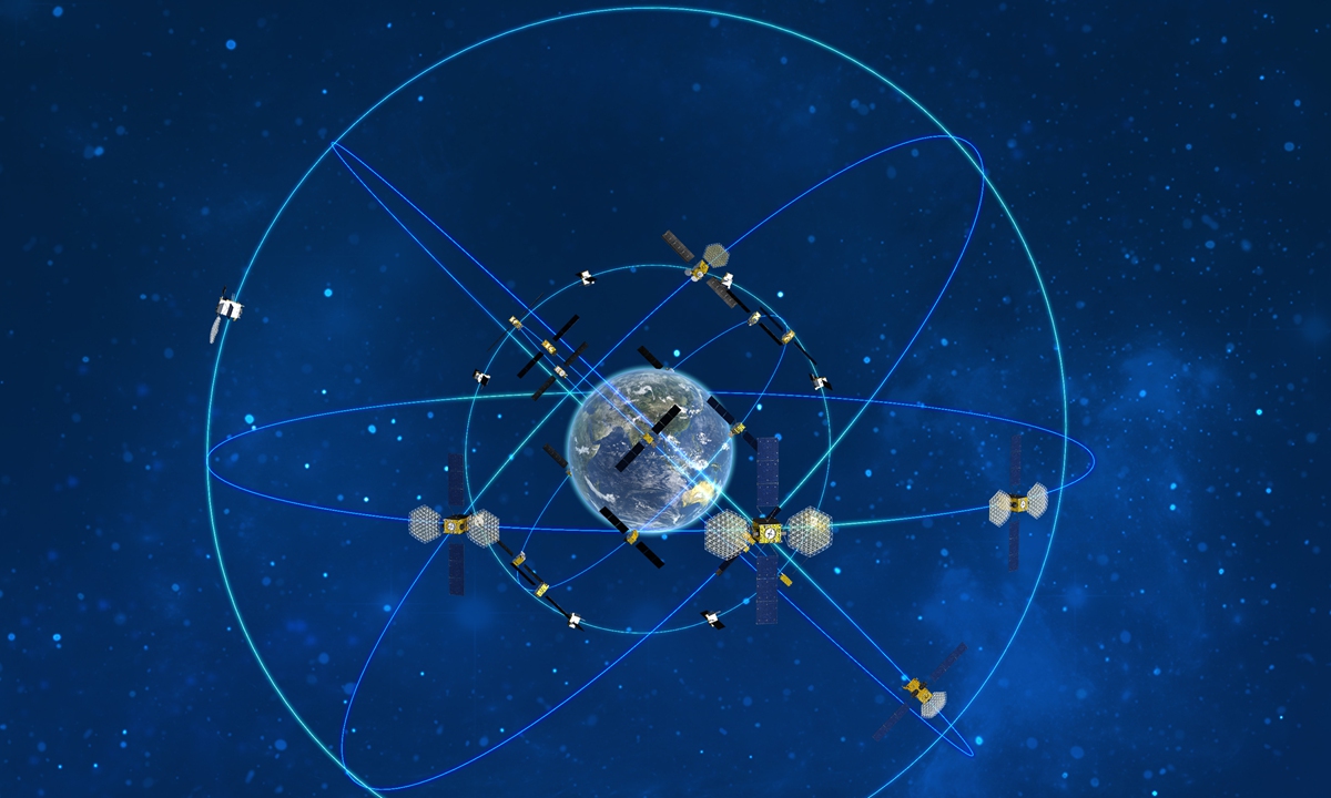
The PLAASF controls all of China's military satellites, as a well as the BeiDou satellite navigation system.[11] This space force is estimated by the Military Balance 2024[12] to be around 245 satellites, plus perhaps some dual-use civilian satellites.

As is common in all countries with significant space forces, exact data on China's military satellites' functions is hard to come by. The generic "Yaogan" name is used for military satellites, and only sometimes is the actual military designation released (like the "Jianbing" series). Often, launches are disguised and receive civilian designators, at least for a period.

In counter-sat functions, while as of 2024 the PLAASF does control three possible ASAT satellites, it is unlikely it has command of the SC-19 anti-satellite missiles under the PLARF control.

Imagem
Imagem
Imagem


Avatar do usuário
Suetham
Sênior
Sênior
Mensagens: 9623
Registrado em: Ter Abr 12, 2022 9:10 am
Agradeceu: 297 vezes
Agradeceram: 615 vezes

Re: Força Aeroespacial - Exército de Libertação Popular(China)

#2 Mensagem por Suetham » Sáb Jun 15, 2024 3:13 pm

https://thediplomat.com/2024/05/the-reo ... lications/
The Reorganization of China’s Space Force: Strategic and Organizational Implications
The rationale behind the new “Aerospace Force.”

https://jamestown.org/program/a-disturb ... ort-force/
A Disturbance in the Force: The Reorganization of People’s Liberation Army Command and Elimination of China’s Strategic Support Force

https://spacenews.com/china-reorganizes ... perations/
China reorganizes its military, impacts likely for space operations

https://thediplomat.com/2024/04/rip-ssf ... ructuring/
RIP, SSF: Unpacking the PLA’s Latest Restructuring
The Strategic Support Force is no more, and its functions are being separated into three separate arms: the Aerospace Force, Cyberspace Force, and Information Support Force.


Avatar do usuário
Suetham
Sênior
Sênior
Mensagens: 9623
Registrado em: Ter Abr 12, 2022 9:10 am
Agradeceu: 297 vezes
Agradeceram: 615 vezes

Re: Força Aeroespacial - Exército de Libertação Popular(China)

#3 Mensagem por Suetham » Sáb Jun 15, 2024 3:13 pm

https://capsindia.org/chinas-military-r ... ace-force/
https://capsindia.org/wp-content/upload ... 1_5_24.pdf
China’s Military Reorganisation and the Emergence of an Aerospace Force


Avatar do usuário
Suetham
Sênior
Sênior
Mensagens: 9623
Registrado em: Ter Abr 12, 2022 9:10 am
Agradeceu: 297 vezes
Agradeceram: 615 vezes

Re: Força Aeroespacial - Exército de Libertação Popular(China)

#4 Mensagem por Suetham » Sáb Jun 15, 2024 3:15 pm

Cientistas testam inteligência artificial para proteger espaçonave chinesa

De acordo com um novo estudo de cientistas chineses, um transportador orbital controlado por inteligência artificial pode ser usado para patrulhar e repelir ataques no espaço. Uma grande plataforma orbital com centenas de cubsats - pequenos satélites pesando cerca de 1 kg - poderia proteger de forma rápida e eficaz os ativos espaciais da China. Mas será necessária a ajuda da inteligência artificial para determinar exatamente quando e onde liberar os cubesats para que eles possam se defender dos satélites inimigos.

Segundo os pesquisadores, a complexidade de uma batalha espacial grande e rápida estaria além dos limites do cérebro humano – e até mesmo além dos limites de alguns poderosos algoritmos de inteligência artificial.
Breaking: New satellite imagery from BlackSky suggests China is operating laser anti-satellite weapons (ASAT) to engage western satellites. The Korla East Test Site is used to develop technology that could disrupt, destroy or hijack foreign satellites.
https://www.army-technology.com/feature ... atellites/

China is displaying its home-grown civil and military aviation technology at the Zhuhai Airshow.

https://interfax.com/newsroom/top-stories/83370/
Russia, China sign deal on mutual deployment of Glonass, Beidou satellite navigation systems in their territories - Roscosmos
MOSCOW. Sept 27 (Interfax) - Russia and China have signed contracts for the deployment of Russian Glonass satellite navigation system stations in China and China's Beidou system stations in Russia, Roscosmos said on Tuesday.

"In the presence of Roscosmos CEO Yury Borisov and Chairman of the China Satellite Navigation Committee He Yubin, the parties signed contracts on the deployment of Russian Glonass system stations in China and China's Beidou system stations in Russia," it said.

Three Russian measurement stations should be built in the Chinese cities of Changchun, Urumqi, and Shanghai, and three Chinese stations in Russia's Obninsk, Irkutsk, and Petropavlovsk-Kamchatsky, it said.

"The simultaneous use of the Russian and Chinese systems, Glonass and Beidou, provides more accurate and reliable navigation. Therefore, we are sincerely interested in expanding cooperation in the use of Glonass and Beidou systems, as well as navigation technology on their basis," Roscosmos quoted Borisov as saying.

Russia and China will keep expanding and strengthening their cooperation on satellite navigation and space exploration, he said.

The meeting participants also signed a statement by the Information and Analysis Center for Positioning, Navigation and Timing (IAC PNT) at Roscosmos's TsNIImash Central Research Institute of Machine-Building and the China Satellite Navigation Office's Testing and Evaluation Research Center on jointly offering informational support services to both Glonass and Beidou customers.

In 2018, Russia and China signed an agreement on cooperation on the civilian use of Glonass and Beidou satellite navigation systems.
https://www.globaltimes.cn/page/202209/1276433.shtml
Breathtaking rescue fixes satellite glitch and ensures 100% success rate of China’s BDS deployment
Imagem

https://posts.careerengine.us/p/61a1af6 ... 58b3945f95
https://posts-careerengine-us.translate ... r_pto=wapp
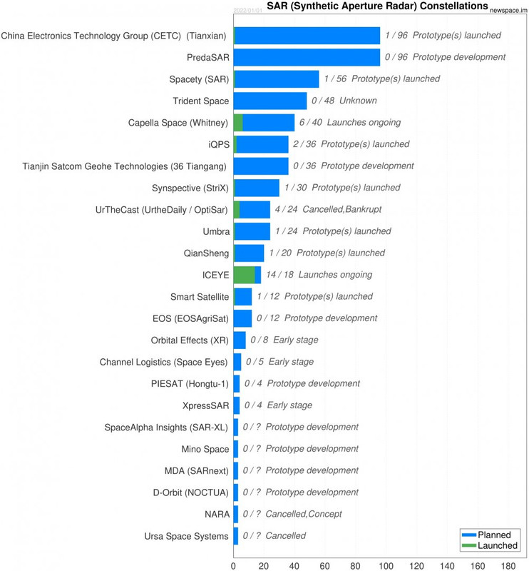
Visão geral do desenvolvimento de satélites SAR na China

Visão geral das constelações SAR comerciais
Imagem

https://spacenews.com/china-launches-ne ... abilities/
China launches new Gaofen-11 high resolution spy satellite to match U.S. capabilities

A LEO comms+observation constellation with crosslinks would put Europe on equal standing with the US SDA constellation and the one the Chinese are bound to launch. It's going to be one of the attributes defining a 21st century superpower.
Comparação de resolução entre o Yaogan-29 SAR e o alemão TerraSar-X.
Imagem

https://www.scmp.com/news/china/science ... satellites
Chinese physicists simulate nuclear blast against satellites

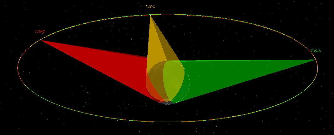
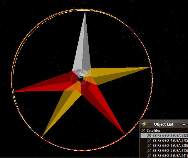
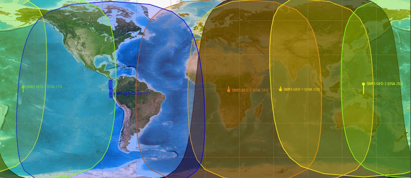
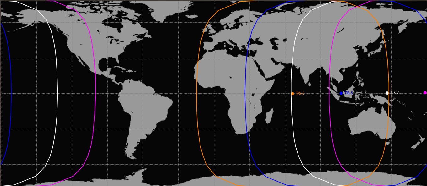
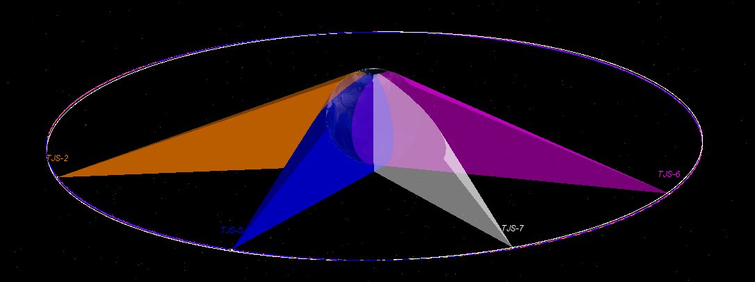
Uma comparação entre os TJS e os SBIRS

Imagem

Imagem
Imagem

Imagem
Imagem
O TJS-3 é tão único na matriz que é fabricado pela Academia de Tecnologia de Voo Espacial de Xangai (SAST), que fez todos os outros satélites EW da série TJS, mas não se parece com um satélite EW. Talvez o TJS-3 possa ser um protótipo para o satélite EW de próxima geração, mais leve e mais barato, semelhante à proposta dos EUA para o sistema EW de próxima geração.

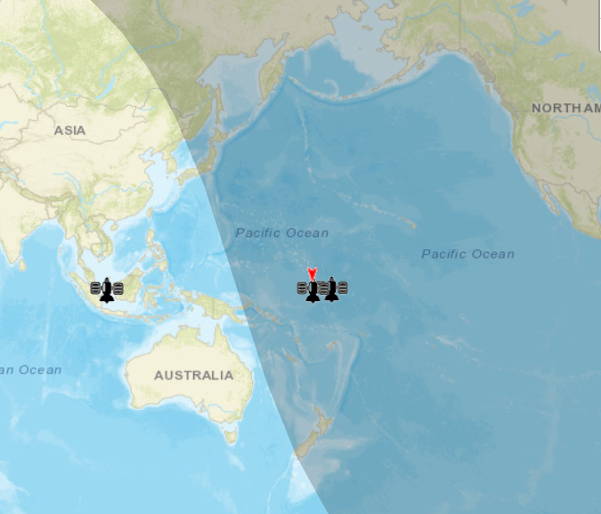
Como mostra a animação de SegerYu, 4 satélites GEO EW atuais fornecem cobertura sobre toda a Eurásia e Pacífico. Deve haver mais 2 satélites EW GEO para cobrir o CONUS/Atlântico e pelo menos 3 satélites HEO para cobrir o hemisfério norte.

Os EUA estão eliminando os satélites GEO, HEO EW dentro de duas décadas, bem, pelo menos eles disseram isso publicamente, e mudam para constelações LEO e satélites MEO para atender às preocupações da China.
https://spacenews.com/dod-to-end-procur ... atellites/


Avatar do usuário
Suetham
Sênior
Sênior
Mensagens: 9623
Registrado em: Ter Abr 12, 2022 9:10 am
Agradeceu: 297 vezes
Agradeceram: 615 vezes

Re: Força Aeroespacial - Exército de Libertação Popular(China)

#5 Mensagem por Suetham » Sáb Jun 15, 2024 3:18 pm

https://spacenews.com/space-force-to-se ... e-to-ours/
Em apenas cinco anos, a China implantou mais de 260 satélites de imagem e cerca de 50 satélites de navegação, acrescentou. “Suas capacidades espaciais ainda não são tão boas quanto as nossas, mas são muito, muito boas. E, portanto, temos que assumir que eles são concorrentes nesse sentido.” Eles são melhores do que nós? Eles vão ganhar? Estamos em paridade? Não posso dizer isso”, acrescentou Thompson. “Tudo o que posso dizer é que eles são um desafio sério. Eles são uma ameaça séria. Suas capacidades estão próximas às nossas.

A China parece ter considerado aumentar suas capacidades de consciência situacional espacial colocando um satélite em uma órbita retrógrada no cinturão geoestacionário. Um satélite informante orbital em retro-GEO, no entanto, seria capaz de passar por todos os ativos em GEO a cada 12 horas. Isso permitiria uma rápida catalogação de detritos, bem como movimentos de outros satélites, fornecendo informações importantes sobre uma órbita altamente valorizada.
https://spacenews.com/china-looked-at-p ... -the-moon/
China looked at putting a monitoring satellite in retrograde geostationary orbit via the moon
Constelação de Jilin-1 para expandir de 138 para 300 satélites.
https://spacenews.com/chinese-commercia ... tellation/
Chinese commercial remote sensing satellite firm to double size of constellation

China se tornando mais ativa em GEO. “Existe um jogo de gato e rato absoluto que está acontecendo no GEO agora. Por um período de tempo, sempre que os satélites GSSAP (Programa de Conscientização da Situação Espacial Geossíncrona dos EUA) aparentemente estivessem se aproximando dos satélites, você os veria apenas se dispersando.”
https://spacenews.com/space-force-brief ... attention/
Space Force briefing on military space race catches Jeff Bezos’ attention


Imagem

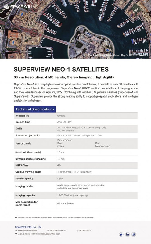
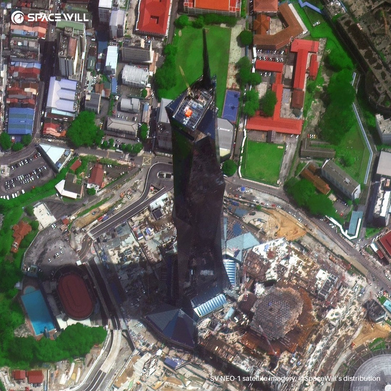
SuperView Neo-1 é uma constelação de satélites ópticos de altíssima resolução, consiste em mais de 16 satélites com resolução de 20-30 cm no programa
Imagem
Imagem
Imagem
Imagem

https://www.scmp.com/news/china/diploma ... new-ground
China and Russia to boost satellite navigation systems with new ground stations

As estações terrestres GLONASS estão sendo construídas na China e vice-versa para Beidou. Isso daria a Beidou uma melhor cobertura perto do Ártico. Observe que uma estação foi construída na Península de Kamchatka, oposta ao Alasca, e pode ter fortes implicações marítimas e militares. Em geral, o GLONASS pode servir como um backup no caso de um grande número de satélites Beidou ficar offline em um conflito, e o GPS é completamente cortado para uso civil.

Satélite Jilin-1


#PRC #satellite launches are adding up.
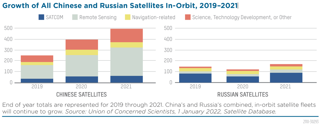
Since 2018 #China's nearly-doubled its on-orbit intelligence, #surveillance & recon/#ISR systems to >260!
(#2 only to US in #s)
Look how far PRC #space-based surveillance architecture
Imagem

De acordo com o China Military Power Report 2022, a China possui 260 satélites ISR, cerca de 50% dos sistemas ISR do mundo. A China lança de 20 a 30 satélites ISR por ano desde 2018.


O PIESAT planeja construir uma constelação de 38 satélites: Nuwa-1, incluindo 28 SARs e 10 satélites de imagens ópticas. Os primeiros 4, denominados PIESAT-1, estão planejados para serem lançados em 30 de março de 2023.
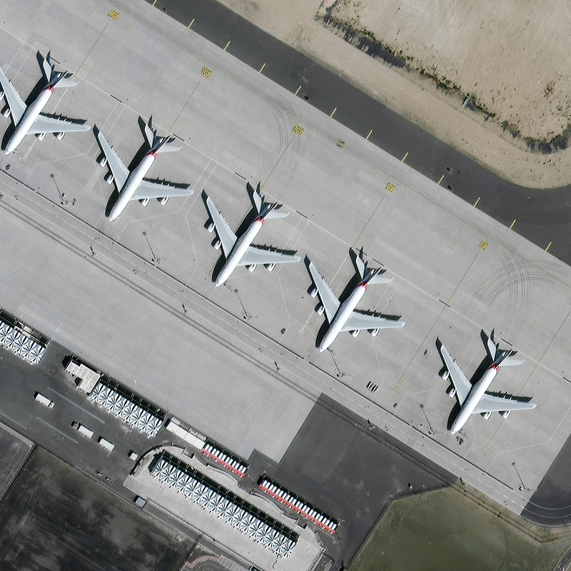
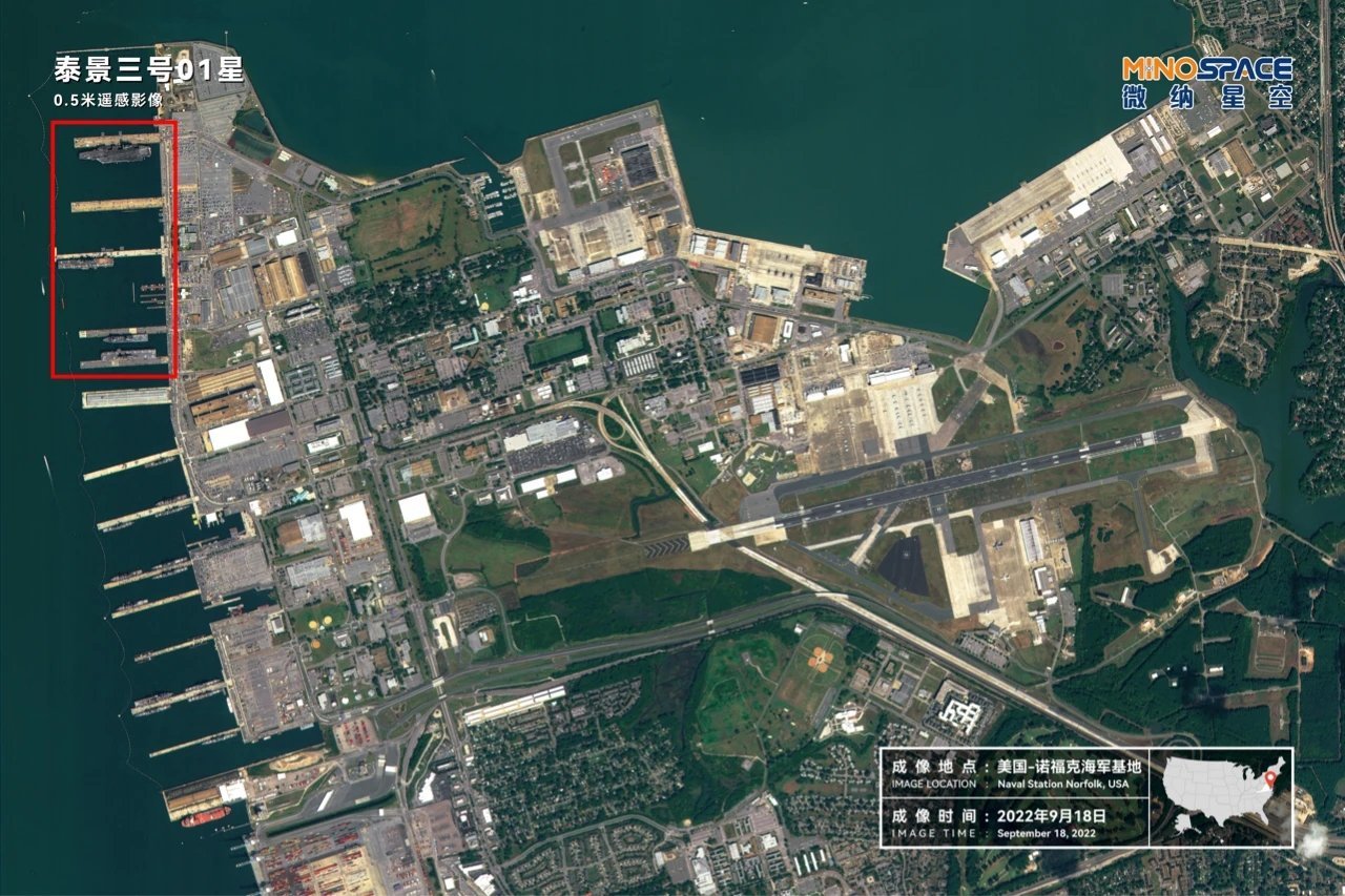
Algumas imagens obtidas pelo satélite Taijing-3 01 da constelação de sensoriamento remoto óptico de órbita baixa de Taijing. O satélite tem uma resolução de 0,5m. Observe que as imagens abaixo não têm resolução de 0,5 m, mas são imagens de acesso livre em resoluções de 2 a 5 metros.
Imagem
Imagem

https://breakingdefense.com/2023/01/chi ... 22-report/
China tops US in defense-related satellites orbited in 2022: Report

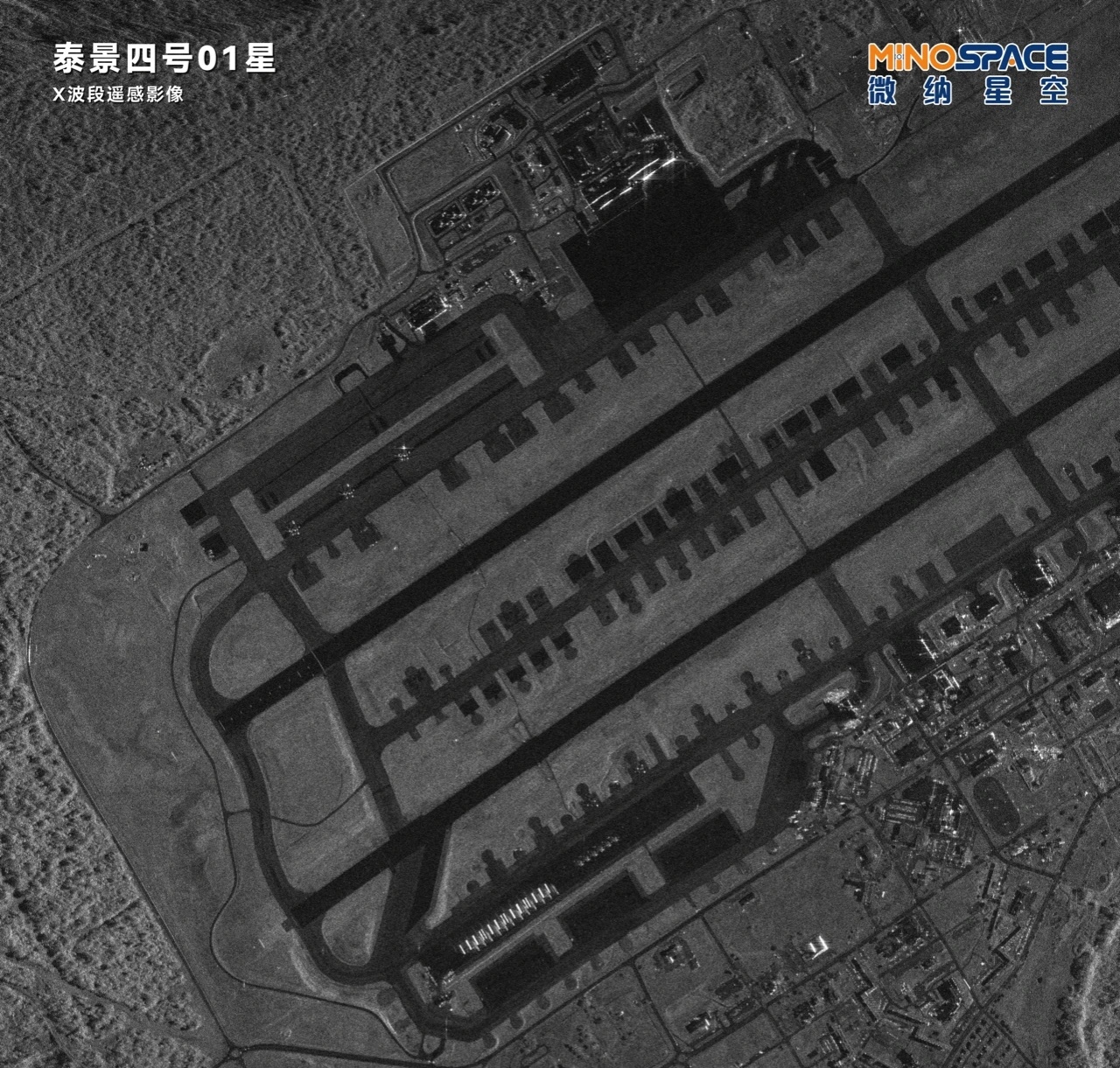
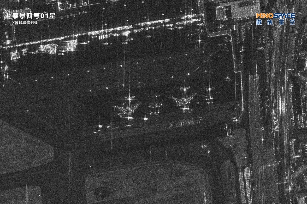
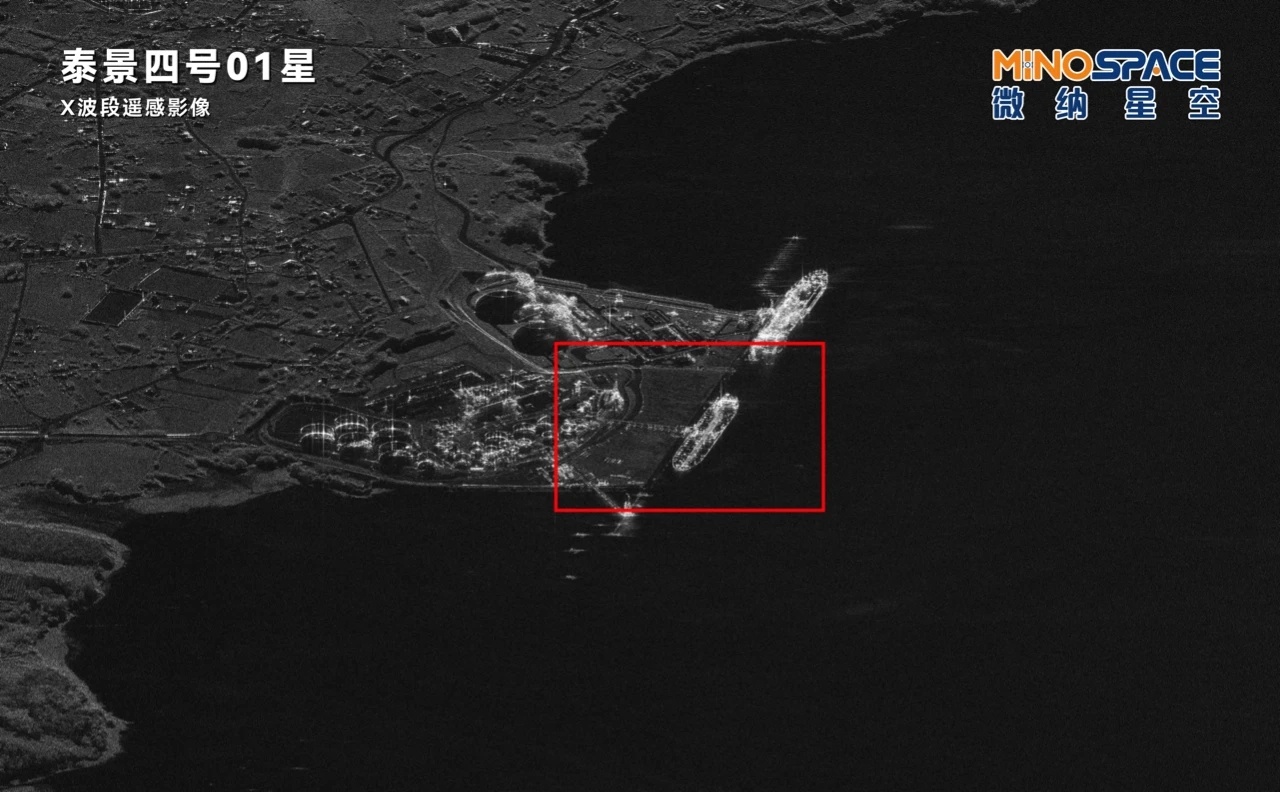
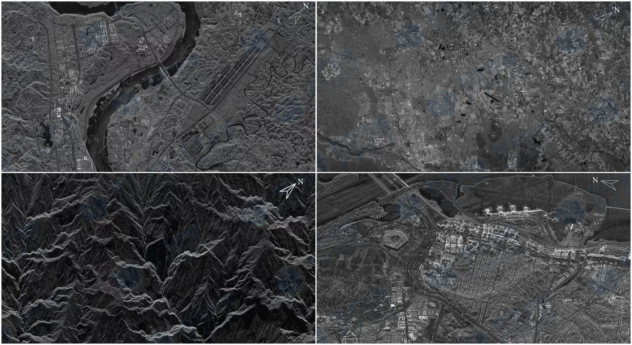
Imagens obtidas pelo radar de observação SAR de banda X Taijing-4. A resolução é melhor que 1m. Os locais são a Base Aérea de Anderson, o Aeroporto Internacional de Miami e o Porto de Vigo.
Imagem
Imagem
Imagem
Imagem

O BIS adiciona 86 novas empresas à lista de entidades do Bureau para apoiar a invasão russa da Ucrânia. Isso inclui sete entidades chinesas que "contribuem significativamente para a base industrial militar e/ou de defesa da Rússia". A lista inclui a China HEAD Aerospace, que tem acesso a 91 satélites de observação da Terra. Outra empresa chinesa de satélites está fornecendo imagens de satélite para Rússia.

https://public-inspection.federalregist ... -03929.pdf
Imagem
Imagem
Imagem


Avatar do usuário
Suetham
Sênior
Sênior
Mensagens: 9623
Registrado em: Ter Abr 12, 2022 9:10 am
Agradeceu: 297 vezes
Agradeceram: 615 vezes

Re: Força Aeroespacial - Exército de Libertação Popular(China)

#6 Mensagem por Suetham » Sáb Jun 15, 2024 3:20 pm

https://www.gpsworld.com/directions-202 ... ues-apace/
Directions 2023: BDS Development Continues Apace

https://www.scmp.com/news/china/science ... thold-west
China’s Beidou satellite navigation system gets a stronger foothold in the West
China’s answer to GPS is now more powerful than ever, thanks to 2 ground stations in North America
As Beidou satellite system grows, so do government worries the technology could be used as a spy tool
https://www.gisreportsonline.com/r/chin ... on-system/
Beidou: Assessing China’s alternative to GPS

https://english.news.cn/20230428/9a60b8 ... e83/c.html
China Focus: BeiDou readies next generation of satellites

https://www.chinadailyhk.com/hk/article/331427
China's new Beidou satellite launches into orbit

https://www.globaltimes.cn/page/202305/1290879.shtml
BeiDou navigation satellites welcomes new, stronger member after 3 years

https://news.cgtn.com/news/2023-05-17/C ... index.html
CGTN talks with chief architect of China's BeiDou Navigation Satellite System

On January 8, 2023, Lin Baojun, chief designer of the Beidou-3 satellite system and vice president of the Institute of Microsatellite Innovation of the Chinese Academy of Sciences, gave a speech at Fudan University, saying that the overall core indicators of the Beidou navigation system More than GPS.

Recall that on December 27, 2018, at the press conference of the State Council Information Office, Ran Chengqi, director of the China Satellite Navigation System Management Office and spokesperson for the Beidou Satellite Navigation System, officially announced that the basic system of Beidou-3 was completed and began to provide global services. .

At this time 4 years ago, the service index promised by the Beidou system was a positioning accuracy of 10 meters, and now it has achieved 5 meters or even better (the global non-differential positioning accuracy of GPS civil C/A code is about 10 meters). Areas can achieve a positioning accuracy of 2 to 3 meters.

As for Beidou's timing accuracy external service, the commitment 4 years ago was 20 nanoseconds, and now it can provide 10 nanosecond timing accuracy (after canceling SA interference, the two-way timing accuracy of GPS civilian C/A code is about 20-nanoseconds).

As of November 2022, AutoNavi Maps has called Beidou satellites for more than 210 billion times a day, and the Beidou call rate has surpassed other satellite navigation systems such as GPS.
http://pt.china-embassy.gov.cn/pot//kjj ... 625832.pdf
China’s BeiDou NavigationSatelliteSystemin the NewEra

China to build a wider, smarter, and more integrated national comprehensive space-time system by 2035 with next-generation BeiDou Navigation Satellite System as core, China Satellite Navigation Office said, adding BeiDou-3 system has proved its quality since its operation in 2020
https://www.cnbc.com/2023/07/29/china-t ... eidou.html
How China is threatening U.S. GPS dominance with Beidou

Duas imagens SAR tiradas pelos satélites InSAR Siwei Gaojing-2 que foram lançados em julho passado.
Imagem
Imagem

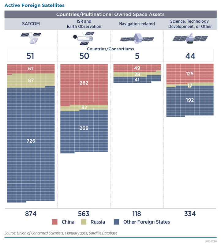
O ELP possui metade dos satélites em órbita de vigilância mundial

Imagem
Imagem
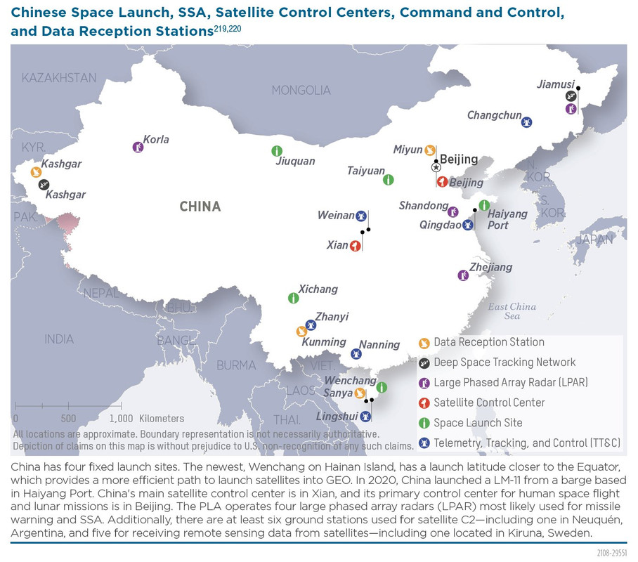
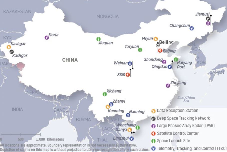
Locais de centros de controle, centros de lançamentos...
Imagem

https://finance.yahoo.com/news/china-mu ... 46213.html
China must destroy Elon Musk's satellites with ‘hard kill’ weapon, say academics
China needs a “hard kill” weapon to destroy Elon Musk’s Starlink satellites, a state university with close links to the country’s communist regime has said.
Researchers from the Beijing Institute of Tracking and Telecommunications Technology called Starlink a threat to China’s national security because of its “huge potential for military applications”.
Starlink is Elon Musk’s global connectivity project, consisting of thousands of satellites in a near-Earth orbit paired with ground terminals giving its users high speed internet access.
In a paper published in China’s Modern Defence Technology journal, the five-strong team of academics say Starlink could be used by the US military and called for China to develop weapons to destroy the internet connectivity network. The paper said: “It is necessary to further develop related technologies and form disposal capabilities.”
https://gaodawei.wordpress.com/2022/05/ ... rmeasures/
PRC Defense: Starlink Countermeasures

Artigo interessante sobre o uso de IA pela China para capturar ou desativar satélites
https://asiatimes.com/2022/06/china-use ... ce-battle/
China uses AI deception in simulated space battle
In a paper published on April 25 in the domestic peer-reviewed journal Aerospace Shanghai, Dang Zhaohui, professor of astronautics from Northwestern Polytechnical University, and his colleagues conducted an experiment in which an AI commanded three small hunter satellites to capture a high-value target, repeating the exercise thousands of times.
The researchers also set penalty parameters for the hunter satellites, such as consuming more fuel and colliding with a teammate. In contrast, the target satellite gained points for each penalty incurred by hunter satellites.
https://spacenews.com/an-in-orbit-game- ... and-norms/
An In-Orbit Game of Cat and Mouse: Close approaches prompt calls for communications and norms
Soon after a pair of Chinese satellites reached geostationary orbit early this year, space surveillance satellite USA 270 maneuvered to get a closer look at its new neighbors.

As USA 270 closed in on Shiyan-12-01 and Shiyan-12-02, the Chinese inspection satellites took off in opposite directions with Shiyan 12 02 moving into position to get a sunlit view of the U.S. surveillance satellite.
Algumas imagens obtidas pelo satélite SAR Qilu-1. Qilu-1 é o primeiro satélite SAR compacto da China operando na banda Ku. As três primeiras imagens são varreduras da Estação Naval de Norfolk, obtidas usando formação de feixe submétrica. As duas últimas imagens e o vídeo são de uma varredura em Suzhou na China.
Imagem
Imagem
Imagem
Imagem
Imagem

Pista de decolagem do aeroporto de Shanghai Hongqiao registrado através do satélite JL-1


Avatar do usuário
Suetham
Sênior
Sênior
Mensagens: 9623
Registrado em: Ter Abr 12, 2022 9:10 am
Agradeceu: 297 vezes
Agradeceram: 615 vezes

Re: Força Aeroespacial - Exército de Libertação Popular(China)

#7 Mensagem por Suetham » Sáb Jun 15, 2024 3:23 pm


https://www.airuniversity.af.edu/CASI/D ... re-theory/
China's Space Program Through The Lens of Irregular Warfare Theory

This article examines the question of whether the PRC is using its space program as a method of irregular warfare with the goal of neutralizing the United States as a threat to its goal of achieving global hegemony. For purposes of this paper, a campaign of irregular warfare is defined as a “struggle to influence populations and affect legitimacy.” After examination of Chinese actions in Africa, specifically in the emerging satellite technology sector, the inevitable conclusion must be a resounding yes.
https://www.airuniversity.af.edu/Portal ... Theory.pdf
https://www.airuniversity.af.edu/CASI/D ... c-sources/
Coercive Space Activities: The View From PRC Sources
https://www.airuniversity.af.edu/Portal ... vities.pdf

https://www.airuniversity.af.edu/CASI/D ... logistics/
PLA On-Orbit Satellite Logistics
The People’s Liberation Army (PLA) is preparing its satellite operators to perform on-orbit satellite refueling, for peacetime and wartime space logistics. They are also already integrating lessons learned into corresponding military doctrine and training tools. To further ready a PLA in-space logistics force, a Chinese defense contractor has indicated, for the last six years, that it has a mission ready satellite refueler for geosynchronous Earth orbit (GEO). With more clarity on the PLA’s requirements for satellite logistics, the Chinese Communist Party (CCP) has approved new commercial players to enter the field to provide, not only technology, but also frameworks to shape international norms. These developments have largely gone unnoticed, perhaps because of an overemphasis on a low probability satellite grappling event.
https://www.airuniversity.af.edu/Portal ... istics.pdf
Um relatório sobre as atividades e estrutura da empresa chinesa Chang Guang Satellite Technology Co., Ltd, que se dedica à produção de satélites de sensoriamento remoto no interesse das forças armadas chinesas.
https://www.airuniversity.af.edu/CASI/D ... -overview/
Chang Guang Satellite Technology Company overview
This paper provides a brief overview of Chang Guang Satellite Technology Co., Ltd. (CGST), its operations, and connections to the People’s Liberation Army (PLA), the People’s Republic of China (PRC) government, and the Chinese Communist Party (CCP). Previously known in English as Charming Globe, CGST is a remote sensing satellite company based in the PRC.
https://www.airuniversity.af.edu/Portal ... erview.pdf
https://www.airuniversity.af.edu/CASI/D ... d-control/
PLA Counterspace Command and Control
https://www.airuniversity.af.edu/Portal ... ersion.pdf

https://www.defenseone.com/technology/2 ... rt/376261/
China Could Overtake US in Space Without ‘Urgent Action,’ Warns New Pentagon Report

https://spacenews.com/china-launches-cl ... nary-belt/
China launches classified military satellite towards geostationary belt

https://spacenews.com/why-space-force-i ... n-the-sky/
Why Space Force is growing more alarmed by China’s eyes in the sky
Imagem

https://www.businessinsider.com/china-c ... ral-2024-3
China may be developing plans to take out US satellites from the moon, Space Force general says

Satélites militares e civis chineses em GEO
https://www.uscc.gov/sites/default/file ... timony.pdf
Imagem

https://spacenews.com/china-launches-se ... atellites/
China launches second batch of Yunhai-2 satellites

Lançado satélite meteorológico militar Yunhai-3-02


https://spacenews.com/chinas-military-i ... refueling/
China’s military is taking a strategic approach to on-orbit refueling

https://www.airandspaceforces.com/ussf- ... reaten-us/
Advancing in Space, China Poses Growing Threat, USSF Leaders Warn

Massa total de satélites governamentais (civis e militares) lançados: China vs EUA vs Rússia
Imagem

Primeiras imagens transmitidas pelo Oriental Smart Eye Gaofen 01, um satélite multiespectral de sensoriamento remoto com resolução <0,5m.
Imagem
Imagem
Imagem
Imagem

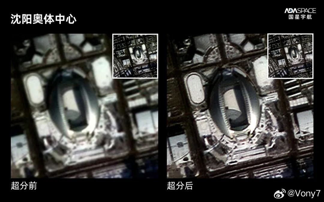
Primeiras imagens (de Shenyang) transmitidas pela Star Epoch 18:
Imagem
Imagem

https://spacenews.com/why-space-force-i ... n-the-sky/
Why Space Force is growing more alarmed by China’s eyes in the sky
Imagem

https://spacenews.com/china-launches-cl ... nary-belt/
China launches classified military satellite towards geostationary belt


CHINA YAOGAN-35/36/39 SIGINT SATELLITES


CHINA Yaogan-30 SIGINT Constellation satellite

https://idstch.com/space/chinas-escalat ... ancements/
China’s Escalating Space Militarization: Assessing Destructive ‘Counter-Space’ Capabilities and Weapons Advancements

https://spacenews.com/u-s-space-force-w ... ite-fleet/
U.S. Space Force wary of China’s expanding spy satellite fleet
The U.S. military dismisses China’s claims that its reconnaissance satellites are for civilian purposes
Imagem
Imagem

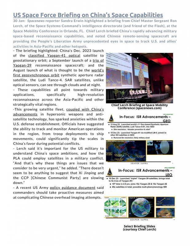
Sargento da USAF, Ron Lerch, diz que a China adicionou dois satélites de imagem geoestacionários, um radar óptico e um radar de abertura sintética (SAR) em 2023 e os comandantes do USPACOM devem tomar medidas proativas para complicar os movimentos de suas forças.

https://www.cnbc.com/2023/10/26/investi ... ength.html
Investing in Space: How the Pentagon sizes up China’s military strength in space


Avatar do usuário
Suetham
Sênior
Sênior
Mensagens: 9623
Registrado em: Ter Abr 12, 2022 9:10 am
Agradeceu: 297 vezes
Agradeceram: 615 vezes

Re: Força Aeroespacial - Exército de Libertação Popular(China)

#8 Mensagem por Suetham » Sáb Jun 15, 2024 3:25 pm

https://www.airuniversity.af.edu/CASI/D ... logistics/
PLA On-Orbit Satellite Logistics

The People’s Liberation Army (PLA) is preparing its satellite operators to perform on-orbit satellite refueling, for peacetime and wartime space logistics. They are also already integrating lessons learned into corresponding military doctrine and training tools. To further ready a PLA in-space logistics force, a Chinese defense contractor has indicated, for the last six years, that it has a mission ready satellite refueler for geosynchronous Earth orbit (GEO). With more clarity on the PLA’s requirements for satellite logistics, the Chinese Communist Party (CCP) has approved new commercial players to enter the field to provide, not only technology, but also frameworks to shape international norms. These developments have largely gone unnoticed, perhaps because of an overemphasis on a low probability satellite grappling event.
https://www.airuniversity.af.edu/Portal ... istics.pdf

Satélites civis e militares chineses em órbita geoestacionária para monitorar a situação na região Indo-Pacífico

Mais detalhes no artigo sobre como a China usa capacidades espaciais, aviação e UAVs para coletar informações de inteligência

De acordo com um relatório, no final de 2022, havia um total de 294 satélites civis chineses de detecção remota em operação, dos quais 189 eram satélites comerciais de detecção remota.
https://www.gov.cn/yaowen/liebiao/20231 ... 914808.htm
https://warontherocks.com/2023/11/is-mi ... rry-it-is/
IS MILITARY SPACE-BASED JAMMING NORMAL? SOME WORRY IT IS

Chinese Perceptions

At least some in the People’s Liberation Army Strategic Support Force perceive that the United States and Russia already have on-orbit spacecraft capable of jamming satellite downlink and crosslinks. In 2019, a People’s Liberation Army unit under the Strategic Support Force published an academic assessment of Russia’s LUCH-Olymp satellite, noting that they could not rule out that the satellite was carrying an attack payload, probably referring to an electronic jamming payload given the frequency with which it approaches non-Russian communications satellites. Another Strategic Support Force unit in 2020 published a paper on American electronic satellite jamming systems, and included what they perceived to be U.S. systems in geosynchronous Earth orbit capable of jamming other satellites. The authors judged that the U.S. Geosynchronous Space Situational Awareness Program satellites and other national security satellites were capable of space-based jamming.

China’s Strategic Support Force’s perception that other leading countries already have on-orbit jammers, and their commitment to weakening the U.S.’s ability to use satellites in any potential conflict with China, may have driven them to develop their own experimental on-orbit jammer. At least according to Strategic Support Force technical reports, by 2020 they had tested an experimental on-orbit jamming system, after which they concluded they needed to develop Ka-band capability. In late 2022, the Strategic Support Force received an invention patent for a method to evaluate if a satellite’s on-orbit jamming capability and electronic reconnaissance capabilities were working. None of these documents discuss the Strategic Support Force’s objectives or intentions, nor specific satellites, but they do at least indicate that it has tasked its satellite developers and operators to explore options for on-orbit jamming.
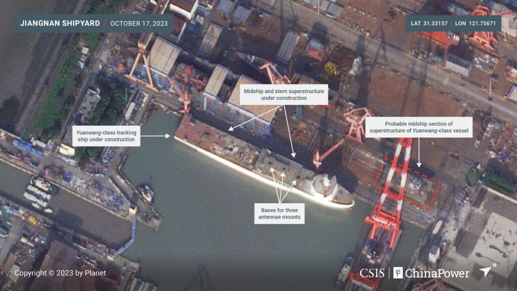
Um novo navio de rastreamento da classe Yuanwang sendo construído para o PLASSF
Imagem

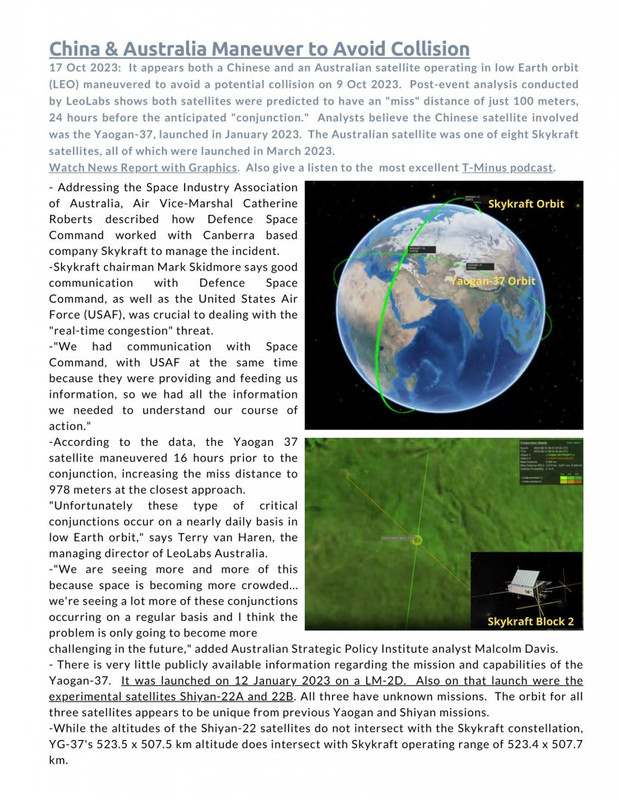
YG-37 manobrou para evitar uma possível colisão com um satélite australiano
Imagem

Atividades do TJS-3 RPO: Suas manobras parecem tê-lo colocado nas proximidades de vários satélites de comunicações militares dos EUA.
Imagem

O GF-13-02 instalou-se em seu slot GEO, expandindo a cobertura da China no Pacífico Ocidental. A China colocou o GF-13-02 significativamente mais a leste do que o GF-13-01, o que permitirá a vigilância mais longe da costa da China. GF-13-02 fica a <2° a leste de Guam e a <1° a leste das Ilhas Marianas do Norte.
Imagem

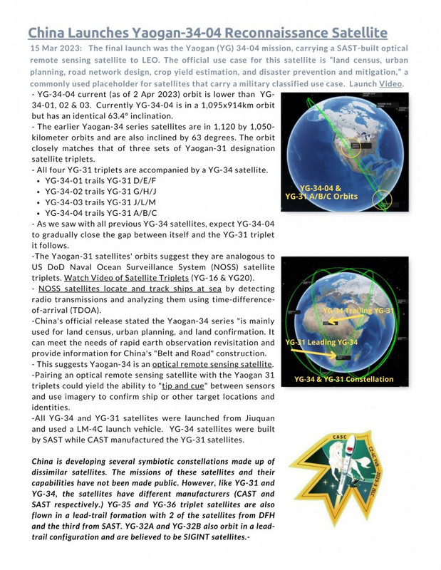
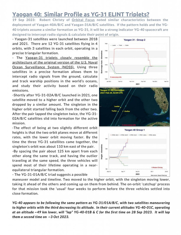
A órbita dos satélites da série YG-34 corresponde muito à de três conjuntos de trigêmeos de satélites Yaogan-31. Todos os quatro trigêmeos YG-31 são acompanhados por um satélite YG-34. Os satélites Yaogan-31 são análogos aos trigêmeos de satélites do DoD Naval Ocean Surveillance System (NOSS) do Departamento de Defesa dos EUA. Os satélites NOSS localizam e rastreiam navios no mar, detectando transmissões de rádio e analisando-as usando diferença de tempo de chegada (TDOA). O emparelhamento do satélite óptico de sensoriamento remoto da série YG-34 com os trigêmeos Yaogan 31 poderia produzir a capacidade de "dicar e indicar" entre sensores e usar imagens para confirmar locais e identidades do navio ou de outros alvos.
Imagem

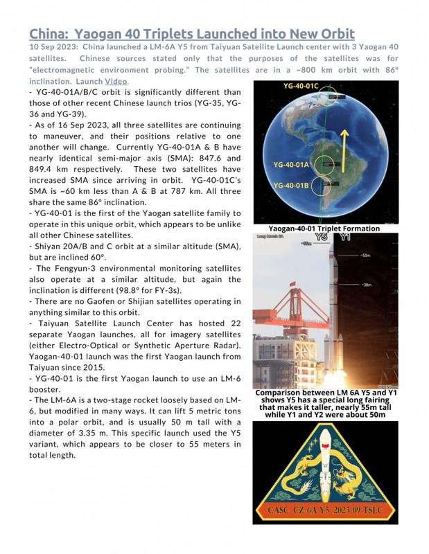
Três espaçonaves do primeiro grupo “Yaogan-40” foram lançadas em órbita subpolar com inclinação de 86°, que até agora quase não foi utilizada na China. No final da década de 1990, os satélites americanos Iridium foram lançados por transportadoras chinesas em órbitas com uma inclinação de 86,4° e, recentemente, em 2021-2023, inclinações de 86,0° e 86,4° foram usadas pela China para lançar satélites experimentais de comunicações em órbita baixa. Vale esclarecer que a órbita escolhida para o YG-40 proporciona uma visão quase global.
Imagem
Imagem

https://chinaspacemonitor.substack.com/ ... adventures
China's Wagner Group Adventures

https://www.lexpress.fr/monde/une-socie ... XFPWURU24/
Une société chinoise a vendu à Wagner deux satellites pour faire du renseignement

CGST JiLin-1 GF03D 12 e 13 sats vendidos para Wagner por US$31 milhões
https://www.airuniversity.af.edu/CASI/D ... e-program/
Trends That Impact Perceptions of the Chinese Space Program
The People’s Liberation Army’s (PLA’s) intention to allow civilian astronauts and non-state-owned enterprise (SOE) companies to participate in the Chinese Space Station (CSS) are two trends that will probably change the global image of the Chinese space program, but which risk being overlooked with hyped attention on the still distant crewed lunar program. While the CSS is not the linchpin for the People’s Republic of China’s (PRC’s) recently confirmed timeline to land two PRC astronauts on the Moon by 2030 for a short period of tests and experiments; the CSS is however necessary for the PRC to achieve its goal for a sustainable crewed lunar program. Importantly, watching the development of the CSS will reveal clues about possible international and commercial participation. Support and buy-in from such groups are key to a sustainable space program and demonstrating the PRC’s leadership in space.
https://www.airuniversity.af.edu/Portal ... rogram.pdf
https://www.recordedfuture.com/near-spa ... ntage?s=08
Near-Space in China’s Military Strategy: Strategic Reconnaissance, Precision Strike, and Battlefield Advantage
https://go.recordedfuture.com/hubfs/rep ... 3-0926.pdf

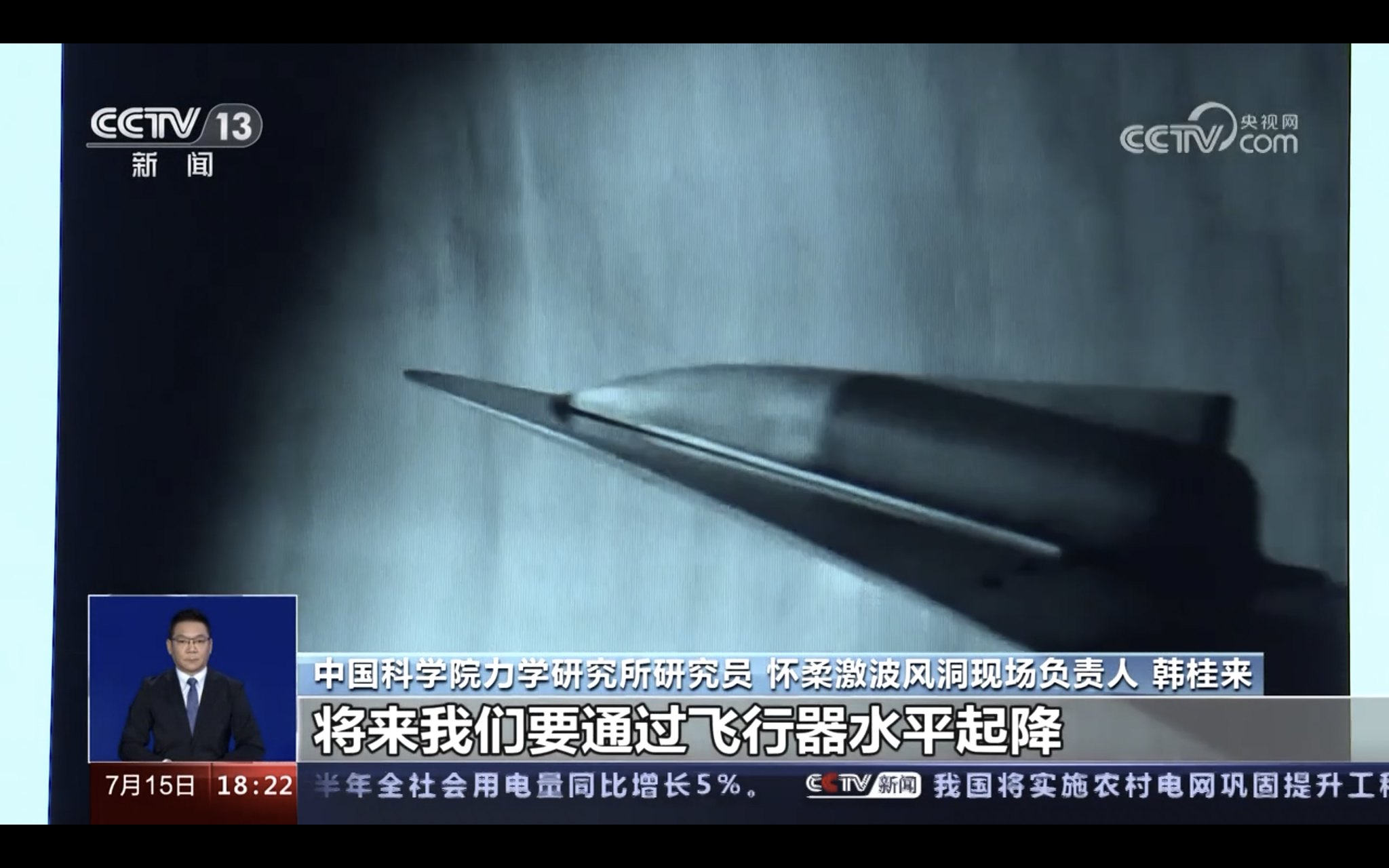
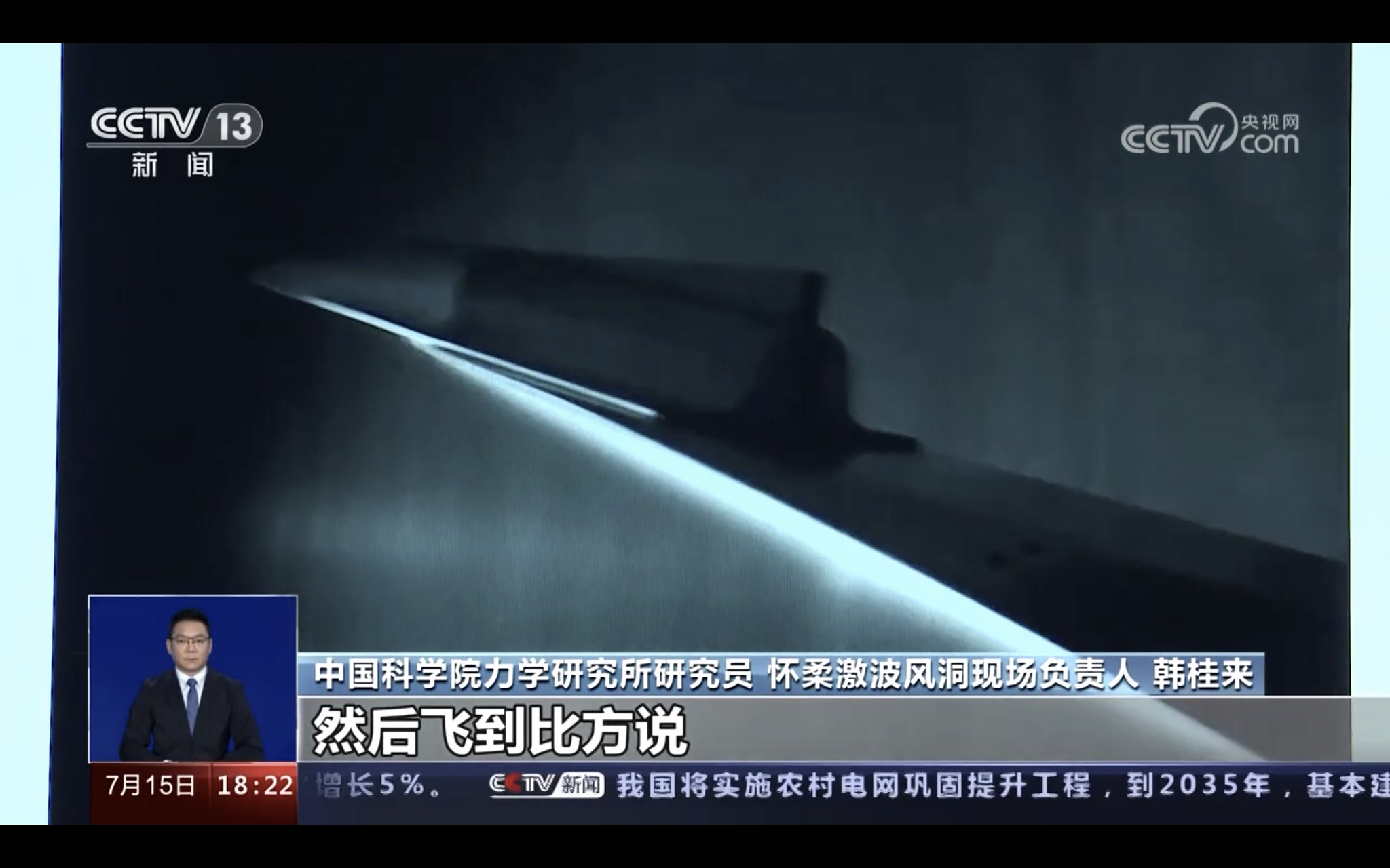
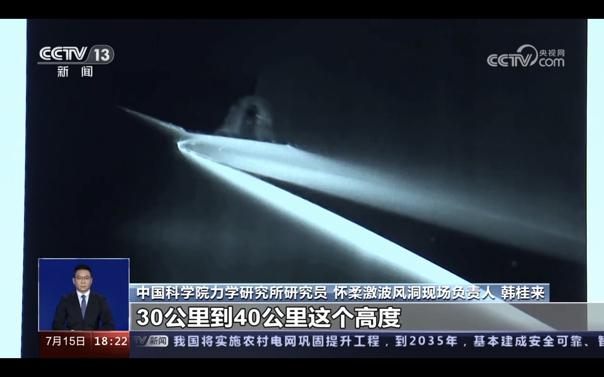
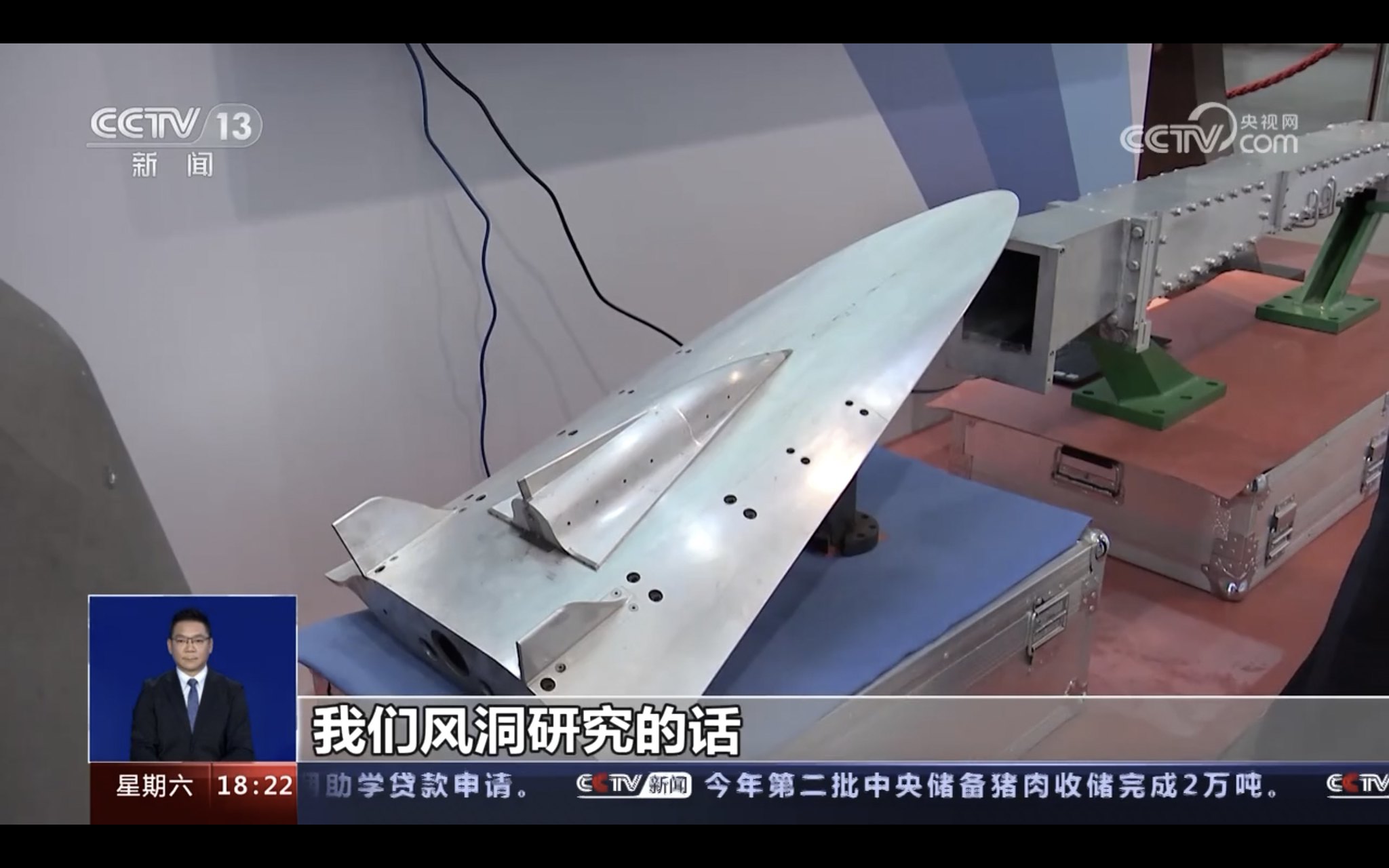
Um teste de separação de um projeto de avião espacial de dois estágios para órbita. O teste foi realizado dentro do túnel hipersônico JF-12.
Imagem
Imagem
Imagem
Imagem
Imagem
Uma vantagem dessa abordagem é que ela pode ser lançada a qualquer momento como um avião, algo que um foguete lançado verticalmente nunca pode fazer. Esta vantagem pode transformar tal lançador em um bombardeiro orbital (dois estágios) ou bombardeiro intercontinental hipersônico (apenas 1 estágio). Assim como ocorreu o lançamento de um HGV derivado de um FOBS em 2021, a China tem se aprofundado no estudo do bombardeio orbital. Para que o conceito funcione, um lançamento horizontal é obrigatório.


Avatar do usuário
Suetham
Sênior
Sênior
Mensagens: 9623
Registrado em: Ter Abr 12, 2022 9:10 am
Agradeceu: 297 vezes
Agradeceram: 615 vezes

Re: Força Aeroespacial - Exército de Libertação Popular(China)

#9 Mensagem por Suetham » Sáb Jun 15, 2024 3:27 pm


A China lançou o primeiro satélite GEOSAR(satélite de observação por radar de abertura sintética lançado em uma órbita geossíncrona) do mundo.

https://www.airuniversity.af.edu/CASI/D ... e-program/
Trends That Impact Perceptions of the Chinese Space Program

The People’s Liberation Army’s (PLA’s) intention to allow civilian astronauts and non-state-owned enterprise (SOE) companies to participate in the Chinese Space Station (CSS) are two trends that will probably change the global image of the Chinese space program, but which risk being overlooked with hyped attention on the still distant crewed lunar program. While the CSS is not the linchpin for the People’s Republic of China’s (PRC’s) recently confirmed timeline to land two PRC astronauts on the Moon by 2030 for a short period of tests and experiments; the CSS is however necessary for the PRC to achieve its goal for a sustainable crewed lunar program. Importantly, watching the development of the CSS will reveal clues about possible international and commercial participation. Support and buy-in from such groups are key to a sustainable space program and demonstrating the PRC’s leadership in space.
https://www.airuniversity.af.edu/Portal ... rogram.pdf
Empresa chinesa vendeu satélites de reconhecimento à Wagner PMC - AFP

O contrato foi assinado em novembro de 2022. De acordo com o contrato visto pela AFP, escrito em inglês e russo e assinado em 15 de novembro de 2022, a Beijing Yunze Technology Co Ltd vendeu dois satélites de observação de alta resolução de propriedade da gigante espacial chinesa Chang Guang Satellite Technology (CGST) para Nika-Frut. , que então pertencia a Prigozhin.

O custo dos próprios satélites e dos serviços adicionais ascendeu a mais de 30 milhões de dólares.

O contrato também previa o fornecimento de imagens mediante solicitação, o que permitiu à Wagner obter imagens de satélite da Ucrânia e de áreas em África onde o PMC operava, incluindo a Líbia, o Sudão, a República Centro-Africana e o Mali.

Uma fonte de segurança europeia disse que o contrato com a empresa chinesa ainda era válido. O contrato prevê a aquisição de dois satélites chineses - JL-1 GF03D 12 e JL-1 GF03D 13, que estão em órbita a uma altitude de 535 km acima da Terra.
Rede de sensores de vigilância espacial na China
Imagem

Lançado em 13 de agosto por um CZ-3B no Centro Espacial de Xichang, o LDTC-4-01 alcançou sua órbita IGSO após 4 manobras orbitais e implantou sua antena de radar SAR de banda L.

O satélite operará sobre o Oceano Índico.
O relatório acadêmico do PLA SSF 2020 sobre o potencial de uso de bloqueadores espaciais contra satélites de retransmissão de dados classificados como Shijian-23 sat foi lançado em janeiro deste ano.
https://m.fx361.com/news/2020/1123/13838595.html?s=08

Estudo futuro registrado sobre o uso de naves quase espaciais (LAVS) pelo PLA para reconhecimento: sondas, balões, plataformas hipersônicas

Peças

▪️Presume-se que o PLA tenha uma frota de LABKs que ajudam a China a realizar reconhecimento estratégico e alerta precoce.

▪️Estas plataformas servem de apoio em caso de falha de satélite e desempenham um papel vital na recolha de informações em tempos de paz. Eles monitorizam a actividade militar estrangeira e recolhem dados sobre tendências e capacidades militares globais.

▪️Os LABK são divididos em plataformas de baixa dinâmica (sondas, balões) e plataformas de alta dinâmica (aeronaves hipersônicas) e podem ser equipados com equipamentos para coleta de diversas informações de inteligência: imagens, sinais, interceptação de mensagens e dados em formato eletrônico.

▪️Embora os satélites militares do PLA ofereçam capacidades robustas de recolha de informações, os LABK são vistos como lacunas complementares. Podem também actuar como meios flexíveis de utilização nas operações ofensivas do ELP, realizando ataques de alta precisão, conduzindo guerra electrónica, organizando comunicações e logística.
O 5º satélite GEO EW entrou em órbita, bem próximo ao TJS-6 sobre o Pacífico.
Imagem

Os satélites Hongtu-1 InSAR enviaram as primeiras imagens.
Imagem
Imagem


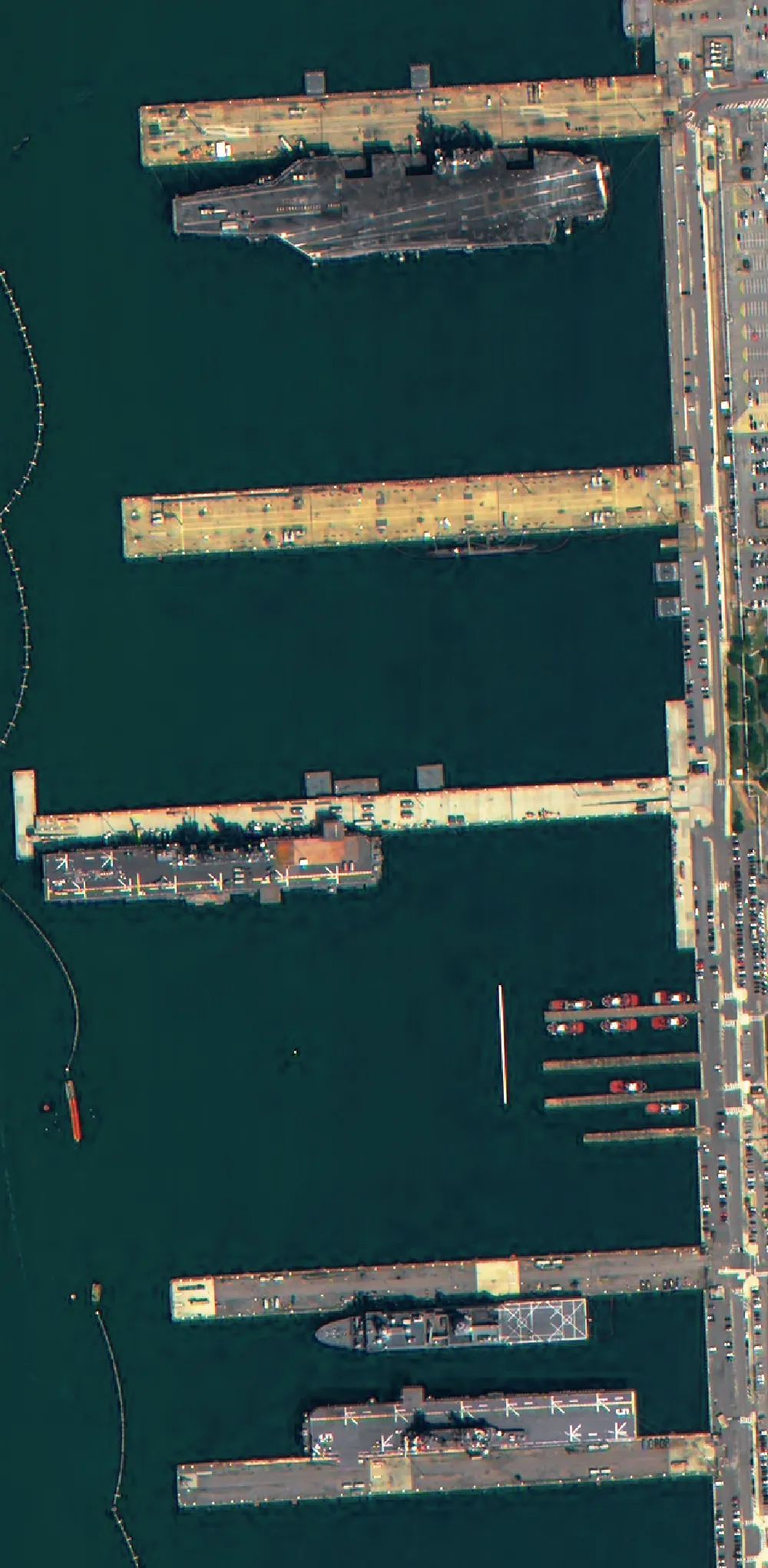
Imagens de porta-aviões e navios de guerra em uma das bases navais dos EUA obtidas do satélite comercial chinês de reconhecimento por radar Taijing-4-03

https://archive.is/rtSKV
https://www.bloomberg.com/news/articles ... force-says
China, Russia Disguise Attack Threats Posed by Their Satellites, US Says
Space Force issues its first public report on adversaries
Efforts cited to ‘deny, disrupt or destroy’ satellites
https://www.newsweek.com/china-military ... ct-1898177
China's Military Satellites Are Watching America's Every Move

A Long March 3B rocket carrying the Beidou-3GEO3 satellite lifts off from China on June 23, 2020. China is challenging the U.S. monopoly on satellite tracking capability, a senior Space Force official said. STR/AFP VIA GETTY IMAGES

China established its version of the Space Force in 2015, which was placed under the hierarchy of the People's Liberation Army's Strategic Support Force (SSF). Chinese President Xi Jinping dissolved the SSF last month, and a new force called the Information Support Force was constituted to merge the SSF's existing remit with it.

China has added over 400 satellites in the past two years, from which more than half have the capability to track objects on Earth, Gagnon said at the Mitchell Institute.

"They will now—in a way that we're not comfortable talking about in America—they will be inside a rapidly expanding weapons engagement zone," Gagnon added.

Gagnon explained that China can now track U.S. military assets even when they are mobile, challenging U.S. monopoly on long-range targeting. The data collected by China's satellites can provide a precise location of military vessels on the move at sea, making their subsequent targeting during conflict easier, according to Gagnon.

"Few countries have that advantage," Gagnon said.

Newsweek reached out to the Chinese Foreign Ministry, the U.S. Space Force and the U.S. State Department for comment via email.

This isn't the first time a senior U.S. Space Force official has warned about China's growing space capability.

General Bradley Saltzman, Chief of Space Operations at the U.S. Space Force, recently raised an alarm about China's exponential growth in satellite-based surveillance capability.

"The PRC has more than 470 [intelligence, surveillance, and reconnaissance] satellites feeding a robust sensor-shooter kill web," Saltzman said in March at the Mitchell Institute's Spacepower Security Forum, according to Air & Space Forces Magazine.

The rapidly declining cost of satellite launches has also spurred a revolution in China's private satellite companies launching new satellites. Chinese companies can now share near-accurate satellite imagery of U.S. military assets on land and at sea.

In 2023, Chinese companies launched 120 commercial satellites, which made up 54 percent of all satellites sent into orbit last year, according to China's state-run news agency Xinhua.

Mino Space, a Beijing-based satellite company, recently published the images of the U.S. Norfolk Naval Base captured with its Taijing 4-03 satellite. Mino Space has emerged as a leading Chinese satellite imagery provider that occasionally showcases its satellite capability by publishing the latest visuals of U.S. military bases and assets.

Mizar Vision, a Chinese satellite imagery provider launched in 2021, has been sharing daily satellite imagery of the military assets participating in the U.S.-Philippines joint exercise, Balikatan, over the past weeks on X-like Chinese social media platform Weibo.

Mizar is closely tracking the movements of the USS Theodore Roosevelt aircraft carrier, currently deployed in the South China Sea for joint exercises with the Philippines. It has also shared imagery of military activity around Taiwan and Japan over the past weeks.
https://interestingengineering.com/spac ... space-rule
China’s satellite can lock target 2 million km away, US worried
China’s successful experiment demonstrates that existing Earth observation systems can be repurposed to enhance early warning capabilities for high-risk asteroids.

O satélite chinês Jilin-1 registrou o voo de um caça americano F-22


Avatar do usuário
Suetham
Sênior
Sênior
Mensagens: 9623
Registrado em: Ter Abr 12, 2022 9:10 am
Agradeceu: 297 vezes
Agradeceram: 615 vezes

Re: Força Aeroespacial - Exército de Libertação Popular(China)

#10 Mensagem por Suetham » Sex Jun 21, 2024 2:48 pm

https://www.airuniversity.af.edu/Portal ... 1/Suss.pdf
ASYMMETRIC WARFARE IN SPACE Five Proposals from Chinese Strategic Thought

Imagens tiradas pelo radar de observação SAR de banda X Taijing-4. A resolução é melhor que 1m. As imagens mostram a base naval de Norfolk e o Centro Espacial Kennedy (complexo de lançamento 39B)
Imagem
Imagem
Imagem
Imagem
Imagem

https://www.defenseone.com/threats/2024 ... ts/396272/
Chinese satellites are breaking the US 'monopoly' on long-range targeting
China “has rapidly advanced in space in a way that few people can appreciate,” Space Force official says.
https://www.airuniversity.af.edu/CASI/D ... e-based-p/
To Be More Precise: BEIDOU, GPS, and the Emerging Competition in Satellite-Based PNT

The United States and the People’s Republic of China (PRC) are in an emerging competition over satellite-based positioning, navigation, and timing (PNT). In 2020, the PRC completed BeiDou 3, a global navigation satellite system (GNSS) similar to the U.S. Global Positioning System (GPS). The PRC now intends to “gain a competitive edge” in satellite-based PNT by making BeiDou more accurate, integrating it into global infrastructures, and expanding its use into new domains.

This paper examines the importance of BeiDou to PRC national power. It argues that the PRC is using BeiDou as an instrument of national power to enhance its global power projection capabilities, international influence, and global commercial competitiveness. In sum, BeiDou assists the Chinese Communist Party (CCP) in achieving its goals of increasing the country’s national power and ushering in a multipolar world and extends the competition between the United States and the PRC to the field of satellite PNT. If PRC plans are successful, BeiDou will enable China’s military to conduct precision strikes against adversaries and could lead to the loss of international influence for the United States and expand market opportunities for PRC commerce.
https://www.airuniversity.af.edu/Portal ... Beidou.pdf

Imagem

http://www.81.cn/yw_208727/16313327.html
Um determinado departamento da força e unidades aeroespaciais militares realizou uma grande discussão sobre o "Conceito de Luta na Nova Era"

https://breakingdefense.com/2024/06/hid ... d-shadows/
Hide and seek: Despite sharper eyes on the heavens, sneaky sats can still find shadows
Hiding in the sun, launching mini satellites and radar absorbent materials are just some of the tricks nations are using to hide their military satellites in orbit.
https://sattrackcam.blogspot.com/2024/0 ... 3-and.html
The Chinese robotic Space Plane 3 and Object G: proximity operations [MULTIPLE UPDATES]


Responder